Index
-
01
Research landscape -
02
Your goal -
03
Plan your stay -
04
Success stories -
05
Our service
- Research landscape
- Your goal
- Plan your stay
- Success stories
- Our service
- Research landscape
Taking the pulse of our planet – Space technologies in environmental and climate research
Pollution, biodiversity loss and climate change are indeed among the most pressing challenges of our time. Looking down at the Earth from space is particularly precious for researchers to better monitor, understand and assess global environmental phenomena.
Fraunhofer IIS
During his mission on board the ISS, German astronaut Alexander Gerst had lots of opportunities to look down on our planet from a distance of around 400 kilometres. In a message to his future grandchildren, he stated: “It looks like we – my generation – are not going to leave this planet in its best condition for you”.
Space-based infrastructures and technologies provide important data to address questions such as: What is the state of our forests and oceans? How is climate change proceeding in remote areas such as the Arctic? How do animals move and react to environmental changes?
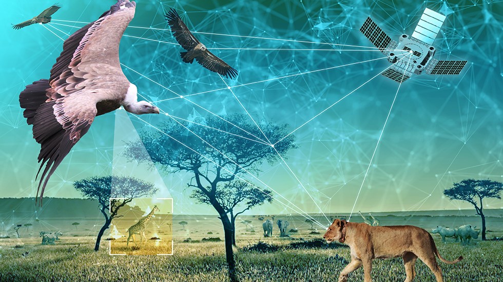
Observing wildlife from space
Studying animals from space helps researchers from German universities and research institutes in many ways. By using and combining sensor and satellite technology, they can observe and analyse the migratory routes and the behaviour of a variety of bird and wildlife species. This enables to better understand the social complexity of animal societies, to track the spread of infectious diseases and to detect environmental and climate change in their habitats. Thus, observing wildlife from space can contribute to protect biodiversity on Earth.
Learn more about this exciting research from our German experts and international researchers working here in Germany.
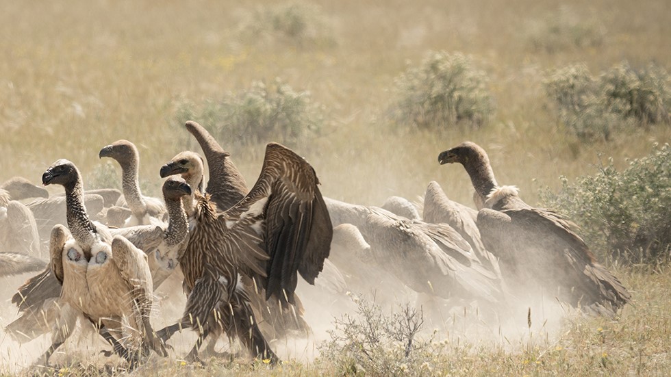
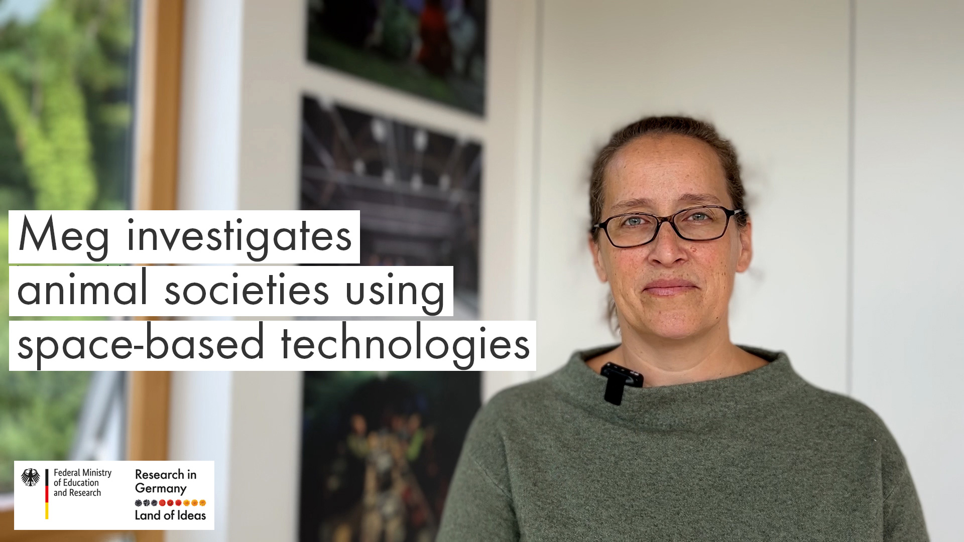
Meg investigates animal societies using space-based technologies
How does social complexity arise in animal societies? And how does the physical world shape the social connections of animals? Meg Crofoot uses space-based technologies to find answers. She is a Director at the Max Planck Institute of Animal Behavior and a Professor at the University of Konstanz.
DLR/Max Planck Institute of Animal Behavior/Untamed Science
The GAIA Initiative – Using Artificial Intelligence to better detect environmental changes
Fraunhofer IIS
The sensory capabilities of many wildlife species are outstanding. Within the GAIA initiative, leading German research institutes, conservation organisations and companies have joined forces to make use of this to foster conservation globally.
In several projects, researchers aim to create a high-tech early warning system for environmental changes in the ecosystems of the wildlife species which they investigate. For this, they combine excellent research on animals and their habitats and innovative technology development using artificial intelligence and satellite-based communication.
GAIA stands for “Guardian of the Wild Using Artificial Intelligence Applications”. It is led by the Leibniz Institute for Zoo and Wildlife Research (Leibniz-IZW) and the Fraunhofer Institute for Integrated Circuits (Fraunhofer IIS). The initiative is supported by the Federal Ministry of Economic Affairs and Climate Action and the German Aerospace Center (DLR).
ExploreEnMAP – The German environmental mission
The Environmental Mapping and Analysis Program (EnMAP) is the first hyperspectral satellite developed and built in Germany. The EnMAP provides data at a hitherto unparalleled spectral resolution. That way, it contributes to questions such as how climate change and human activities affect terrestrial and aquatic ecosystems.
The mission is implemented by the German Aerospace Center (DLR), OHB System and the German Research Centre for Geosciences (GFZ). EnMAP is supported by the Federal Ministry of Economic Affairs and Climate Action.
 is the first hyperspectral satellite developed and built in Germany.")
OHB System AG/DLR
More space research from Germany
Icarus
Icarus stands for International Cooperation for Animal Research Using Space. Within this initiative, researchers use satellites to track animals from space. This provides useful data on the spread of infectious diseases, environmental and climate changes and even natural disasters. Icarus is coordinated in Germany by the Max Planck Institute of Animal Behavior.
Learn more on the website of IcarusGABONX
Researchers at the German Aerospace Center (DLR) are working on technologies to accurately identify and survey forest biomass worldwide with the help of radar satellites. Within GABONX, they have generated radar tomograms of the rainforest in Gabon. Such knowledge is highly relevant to better assess and counter climate change.
Learn more on the website of the DLRRASMUS
RASMUS aims to use ocean currents such as “mesoscale eddies” to analyse and optimise maritime shipping routes in real-time. This could help to reduce the CO2 emissions of cargo ships worldwide. The partners at GEOMAR Helmholtz Centre for Ocean Research and the start-up True Ocean combine Artificial Intelligence and oceanographic models. For their algorithms, they use data of the European Earth observation programme Copernicus.
Learn more on the website of GEOMAR